“National security “National security is beyond mere physical security; it is about the wholesome well-being of the people of a nation. It is a grave matter; therefore, has to be seen seriously. Border security is one among the 16 elements of national security; ocean is one of the eight terrains where the game of national security is played (Paleri, 2022)”
Introduction
The quote above talks about national security. What it doesn’t show up is about the interdependency of the elements and terrains with each other and also mutually together. The efforts to maximise one may reduce the effectiveness of another. Therefore special care is required for wholesome maximisation of results. The governments have to understand this aspect in governance by national security (GBNS). This paper is about border security (Paleri, 2002) one of the elements of national security in the maritime terrain with a few recommendations for India for the attention of the authorities.
Borders separate nations from each other. Most of the national borders are under consensus of the nations that share them. Some are under disputes that may lead to conflicts. Technically, the disputes can be resolved through bilateral or multilateral mechanisms, or following the principles of international law. In such cases there will be mutual consent of the parties that will be binding on each other permanently. It needs effective geostrategy under win-win conditions. Border issues are complex. It can impact national security. Besides territorial sovereignty, they may involve a variety of other concerns specific to the nation in relation to its national security.
The maritime border further complicates the issue. First, it is not linear like the land border. It is more an area than a line. That is one of the reasons why the semantics involved in maritime borders confusingly rest on the term coastal security. It is a term used very loosely. Coastal security is a misnomer in national security decision making. It is more a media term of usage convenience than a decision problem that is diagnostic compatible. It is a landclasped format in decision making on the run. Humans exhibit landclasp syndrome (Paleri, 2014). It is difficult to wean them out of it. Such usage deflects national security strategy for integrating maritime terrain in national security governance. Coastline is internal to the nation. The sovereign rights of a nation extend beyond the coast. There are more on coast in terms of coastal administration. One of them is interfacial marine environment (Paleri, 2009) at the land ocean interface. Coastline is a fractal. Besides it changes shape and dimensions constantly, every minute. It is further aggravated by sea level rise and reclamation anywhere in the ocean (Paleri, 2009). Humans should understand the sea will take away the land they reclaim from it. International law advocates baseline establishment according to tide levels and other parameters to standardise area measurements internal towards land and external towards sea in interfacial administration. Besides, a coast is also four dimensional with sea, land, air and outer space for integration in ocean governance. It is highly dynamic but is not a border of the geoentity. It lies deep inside the territory of a coastland or island nation. That is the key factor why it is not the border. It is similar to a Rann spanning inwards from the border over land. Only it is not land but (territorial sea) water over solid land. That makes a sea coast not a border under maritime law.
Managing the coastal interface and territorial sea of India is within the purview of the nine coastal states and four union territories (UT). Two of the UTs are island territories. It is a centre-state affair in a kind of cooperative federalism for India. There are no coastal issues for a landlocked country, but they too have maritime concerns in national security governance. There are 44 landlocked countries in the world (Paleri, 2009). The interesting part is that they too are maritime nations as the ocean belongs to all being global commons. Ocean is also a serious driver of change for every nation. Landlocked and geographically disadvantaged countries have ocean rights under international law. Some of the landlocked countries are members of International Maritime Organisation (IMO), the specialised agency for maritime affairs related to commercial shipping, and parties to international law and treaties associated with the ocean for this reason.
Another issue related to the ocean is that nations have specific rights even beyond the territorial sea for law enforcement, environmental management and resource exploitation in the high seas. They also have international obligations such as maritime search and rescue operations in assigned areas. Ocean as a global commons exists in the high seas with due considerations to the rights of other countries under international law. The United Nations Convention on the Law of Sea (UNCLOS), 1982 is clear on the subject. The Convention is poised for changes in future based on the experiences of the nations since it became effective. Discussions are on in this regard.
Borders of India
India has land borders with Bangladesh, Bhutan, China, Myanmar, Nepal, Pakistan, and Sri Lanka. There are border disputes with Pakistan and China. The longest border is with Bangladesh (4,096km), whereas the shortest is with Sri Lanka (0.1 km wide) that links the 48 km stretch between Rameswaram (India) and Thalaimannr (Sri Lanka) through Ram Sethu. Ram Sethu divides the historic waters of Palk Bay and Gulf of Mannar as an interface. Sri Lanka will become an island nation if the land border with India gets totally inundated. There are possibilities under the rising sea levels in the near future. A railroad bridge over Ram Sethu or a tunnel under sea to avoid surface disturbances could buttress the friendship between the fine people of the two countries. There were many proposals on it earlier but did not gain attention of the governments. Instead there was a proposal to breach the interface on the Indian side by making a canal that would have been economically, geostrategically and environmentally suicidal if executed. Better wisdom prevailed over the executives who cancelled it under various protests and a serious accident in which a dredger exploded while engaged in dredging.
India shares maritime borders with Bangladesh, Indonesia, Maldives, Myanmar, Pakistan, Sri Lanka and Thailand. In addition India shares the legal continental shelf (LCS) maritime border with Sultanate of Oman.
India has serious land and maritime border issues with Pakistan and land border issues with China. It has minor land issues with Nepal and Myanmar. India can expect potential border security threats across disputed borders leading to armed conflicts unless the problems are resolved. The maritime border concerns are only with Pakistan that has the potential to aggravate by the presence of China when, as reports say, Pakistan gifts the country the two Sindh islands, Budhoo and Bundal, across Karachi especially since the Indo-Pak maritime border is under dispute.
India and the Ocean
India is a coastland (Paleri, 2014) with many islands close to the mainland as well as in the ocean. It has vast territorial sea area. Virtually the maritime border, therefore, should be the perimeters of the territorial sea that extend seawards from the baselines on mainland as well as islands. For administrative convenience and also for explanation, the maritime border becomes an area unlike a line over land in maritime border security decision problems. It is a choice for the government based on its policy of governance by national security. India’s relationship with ocean thereby becomes important. The country has heavy responsibilities in the ocean by its geolocation and being a leading and responsible geoentity.
India is a coastland (Paleri, 2014) with many islands close to the mainland as well as in the ocean. It has vast territorial sea area. Virtually the maritime border, therefore, should be the perimeters of the territorial sea that extend seawards from the baselines on mainland as well as islands. For administrative convenience and also for explanation, the maritime border becomes an area unlike a line over land in maritime border security decision problems. It is a choice for the government based on its policy of governance by national security. India’s relationship with ocean thereby becomes important. The country has heavy responsibilities in the ocean by its geolocation and being a leading and responsible geoentity.
According to a study (Paleri, 2007) and open sources further to it, India’s maritime profile can be projected as given in Table.1. This is a generalised view and is subject to change by time and ocean dynamics.
Table.1 Maritime profile of India (subject to change)
| 1 | CoastlineMainlandLakshadweepAndaman and Nicobar | 7,516.6 kilometers5,422.6 kilometers132 kilometers1,962 kilometers |
| 2 | Territorial sea | 12 nautical miles from the baseline1,55,889 square kilometers45,450 square nautical miles8,682 kilometers perimeter |
| 3 | Contiguous zone | 24 nautical miles from the baseline9,315 kilometers perimeter |
| 4 | Exclusive economic zone | 200 nautical miles from the baseline20,13,410 square kilometers in area5,87,600 square nautical mile |
| 5 | Legal continental shelf | 5,30,000 square kilometers |
| 6 | Maritime search and rescue region | About 4.6 million square kilometers |
| 7 | Deep sea mining area | 1,50,000 square kilometersPioneer investor status (August 1987)1,080 nautical miles south f Cape Comorin |
| 8 | Antarctica | First station Dakshin Gangotri on continental ice shelf (1983). Abandoned in 1990-91. Second station Maitri around 50 miles southeast over land (1988-89). Additional station Bharati (2013) over land in Larsemann Hills. |
| 9 | Arctic | Himadri, located at International Arctic Research base, Ny-Alesund. |
| 10 | Mangroves | 3,565 square kilometers |
| 11 | Coral reefs | 18,000 square kilometers |
| 12 | Major ports | 12 |
| 13 | Minor an intermediary ports | 205 |
| 14 | Private ports | 2 |
| 15 | Fish potential | 4.72 million tonnes |
| 16 | Sea weeds | 624 species |
| 17 | Islands LakshadweepAndaman and NicobarMainland near shore | 1,20636 (inhabited 11, uninhabited 25)572 (inhabited 36, uninhabited 536)598 (447 west, 151 east) |
The maritime security aspects in national security governance should accommodate all these and more for the overall integration of national security based on terrain specificity. It is a major task for the government of a country like India. It can be done by the concept of maximisation of ocean property.
Ocean property
Ocean property (Paleri, 2002) regime facilitates modeling maritime security across the maritime terrain. Ocean property is the graduated all encompassing expression of ocean wealth and utility (use) value as a geoproperty of the nation. It is not about economics alone. It is an idea that comprises four elements. They are:
1.Ocean resources. Ocean resources primarily include living and non-living resources.
2.Ocean advantage. Ocean advantage is the utility value of the ocean. Examples are transportation, trade, industry, energy, depth, military use, peacekeeping operations, geolocation, logistics movement, reach, etc.
3.Ocean environment. Ocean environment includes interfacial environment, coastal zones, marine environment external to interfacial environment, climate, etc.
4.Ocean islands. These are the islands a nation has in the ocean whether near shore or offshore. There are nations that possess ocean islands far distant from the mainland in different ocean divisions.
The idea of ocean property will advocate maritime security in a more objective and convenient manner for modeling maritime security strategy. The challenge is to maximise the ocean property that a nation owns by carefully mapping and scientifically modeling the strategy for governing them to the best advantage. The quantum of ocean property of nations varies. Success is in its maximisation. This is applicable to landlocked countries also.
Contrasting views of land and ocean borders
The difference between borders over land and ocean has been explained. But the interesting aspect is in the perception of their governance when it is about border security. For land, it is about the breach of the border, especially inwards that matters. Whereas for the ocean it is the breach within the terrain as ocean expands to the entire world where the nations will have interests within and over to the land as if ocean is a different entity. The latter appreciation is relevant in the usage of the term coastal security. The maritime zones for a nation in the context of global commons keep changing according to national interests. However, hard and fast rules cannot be established in this context as governance become situational with respect to national security. Within this reference, the term coastal security lap dissolves into the security of border areas for a nation and the ocean around. This can be understood in specific scenarios such as deep sea mining areas, historical waters as between India and Sri Lanka, disputes over Pangong Tso which actually is a part of the World Ocean historically as well as by characteristics sufficient to be termed as Pangong Sagar or Pangong Tso Sagar since shared between India and China and brought under the maritime regime of historic waters for dispute resolution and border administration. It has never been thought so far but the author strongly recommends for mutual acceptability under positive appreciation by India and China.
Unlawful dimension of maritime security and rule of law
The concept of coastal security as widely expressed by discussants and others originated in the context of rule of law in the suppression of unlawful activities at and from the sea. Establishing rule of law is a task of the government. It is expected to be done by the government as part of governance to ensure the safety and security of the people by making law under due process and enforcing it. In the maritime terrain it is about the unlawful dimension of maritime security. Various unlawful activities take place at and from the sea. Suppression of such acts needs law enforcement using forces. The unlawful acts include crimes at sea on board vessels and platforms, maritime piracy and armed robbery, smuggling, trafficking, IUU (illegal, unreported and unregulated) fishing, ghost fishing, marine environmental violations, terrorism, intelligence activities, and various other violations. Enforcement of law to suppress such unlawful activities is the task of not only the target or victim nations but also the advancing global community collectively exercising domestic and international laws as ocean is for all barring exceptions.
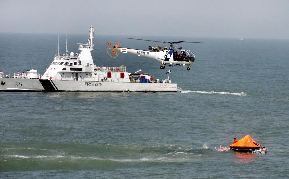
India was distressed and seriously concerned when terrorists were transported by sea from across the Indo-Pak disputed border to Mumbai clandestinely that resulted in the terrorist attack on people and properties on 26 November 2008. It reminded the 12 serial bombings in Mumbai in 1993 which was also linked with coastal waters with internal help. The terrorist attacks in 2008 were much elevated and real time guided. It was a heinous crime against humanity by the most subjugated minds in human systems. The post crime activities were handled by India legally and geostrategically. The wound will linger on and will impact Indo-Pak relations permanently unless superior geostrategy is followed by both the nations under better consciousness. It is unlikely. The issue here is to prevent or preempt such activities in future. In both the cases the unlawful activists and their covert supporters including handlers used the ocean as a medium of transportation under ocean advantage from the point of origin to the destination. It was a direct, covert, external (DCE) (Paleri, 2002) threat to the sovereignty of India. Minimising such advantage to the perpetrators is the task of the government under the rule of law. Many recommendations were made by the expert committee subsequent to the terror attack. One such recommendation was to establish coastal monitoring and surveillance on real time basis by the coast guard around India’s coastline through a chain of ocean surveillance radars. Though it has been activated as recommended, the one proposed at Narcondam Island in Andaman Nicobar was understandably canceled by the government on grounds of environment. It is a serious flaw as such radars are not harmful to the environment at all. It is important that the government should enquire about it and establish one at Narcondam urgently under the accountability of the coast guard who should monitor possible breach. The island is at the eastern most point of India and hence the gateway to India from the east by sea. Any unauthorised breach at that point can cause security problems to India, especially to Andaman and Nicobar Islands, Northeastern states and West Bengal.
Recommendations
This paper includes certain recommendations from the author’s standpoint which can be further highlighted in detail if required. They are enumerated below.
1.Bringing Pangong Tso under maritime identity
Pangong Tso (Pangong Lake) between India and China is considered as a part of land border. It is in reality a part of the World Ocean by prehistoric heritage left behind when the Indian Plate collided with the Eurasian Plate in the Tethys Sea and lifted up by the Himalayas formed under the impact. It exhibits all the ocean characteristics such as pH value, salinity, life environment, conductivity and others; hence qualifies to be treated as a sea and heritage waters. It can be renamed as Pangong Sagar or Pangong Tso Sagar for India-China solidarity with due consideration to Chinese (Pangong), Tibetan (Tso) and Indian (Sagar) traditions.
2.Ram Sethu
Ram Sethu is the ancient scriptural term for the land-water interface between India and Sri Lanka. The colonial British cartographers changed its name to Adams Bridge under their traditions. The practice is still being followed by Indian cartographers especially naval hydrogrpahers. This may be changed respecting Indian traditions and the feelings of people. At least the navigational charts and maps published in India should replace the name Adam’s bridge to Ram Sethu to invoke the pride of people in own traditions.
3.Coastal radar at Narcondam Island
Coastal radar, as planned earlier post 26/11, be installed at Narcondam Island similar to other coastal vantage points for monitoring, control, surveillance and response (MCSR) of vessel movements around India’s easternmost navigable waters by coast guard. It will also provide early information in a marine casualty in the area to Maritime Rescue Coordination Centre (MRCC) of the coast guard at Port Blair.
4.Friendship link—India-Sri Lanka
The long standing proposal for a rail-road friendship bridge across Ram Sethu may be reconsidered by the authorities. It can bring the much needed boost to the millennial friendship between the people of the two nations. It will be an excellent geostrategic confidence building measure (CBM) between the two countries. The link could very well be undersea also.
5.Establishment of ocean property regime
India’s ocean property should be mapped and periodically refreshed for maximising results in the maritime security integration in GBNS. The island security is one of the critical factors of ocean property governance for India at present considering the way international crime syndicates are suing them for committing crimes3 (trafficking in arms, drugs and people) (Paleri, 2022). Enforcement of law by the coast guard under heightened accountability should be ensured by the government.
Conclusions
Border security is one of the elements of national security. In the ocean terrain and associated maritime security governance, it has to be appreciated as an integral part of national security governance and not as a standalone concept. The border is an area concept permanent as well as varying at sea with due consideration under domestic and international laws. India has authority and accountability for protecting its interests in the entire World Ocean, which is an exclusive terrain divided for convenience of governance by the International Hydrographic Organisation (IHO). India shares land, maritime or both borders with 11 neighbours (including Sultanate of Oman across the LCS). There are chances of potential conflicts across the borders with China and Pakistan that remain turbulent. India needs to be careful about governing its security issues within the overall GBNS regime. It can be achieved by cooperative federalism executed competitively under superior leadership at every level through human investment management (Paleri, 2021) and effective use of the enforcement machinery.
(Courtesy: Article published in Seemanta Chetana Mancha, Purvottar, Guwahati, Assam, Souvenir, December 2021.)